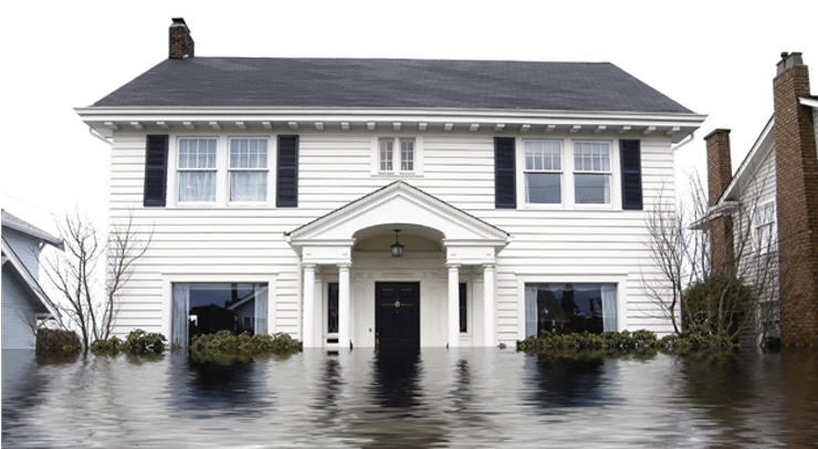
TMAC Recommends Big Changes for How Special Flood Hazard Area is Defined
Earlier this year, the Technical Mapping Advisory Council (TMAC) was tasked with the challenge of developing recommendations that would reduce the number of uninsured losses and improve transparency around the potential impacts climate change and proposed development may have on flood risks to people, property, and the environment.
The request from FEMA centered on whether the definition of the Special Flood Hazard Area (SFHA) should be changed and how fill within those areas could be better managed. TMAC members unanimously agreed that change was needed and, over the course of the past few months, developed six recommendations for reducing future flood losses.
Four of the six recommendations relate to the definition of the SFHA while two have to do with fill placement. TMAC hopes the SFHA recommendations increase confidence in the delineated floodplain boundaries, better communicate the uncertainties in developing the floodplain boundaries, and equip floodplain managers with tools to better manage flood risks.
The Six Recommendations
Listed below are the six recommendations, which are both significant and substantial, and could greatly expand the number of homes required to buy flood insurance. In the report you will also find a narrative discussion following each recommendation to further explain the rationale behind the recommendation.
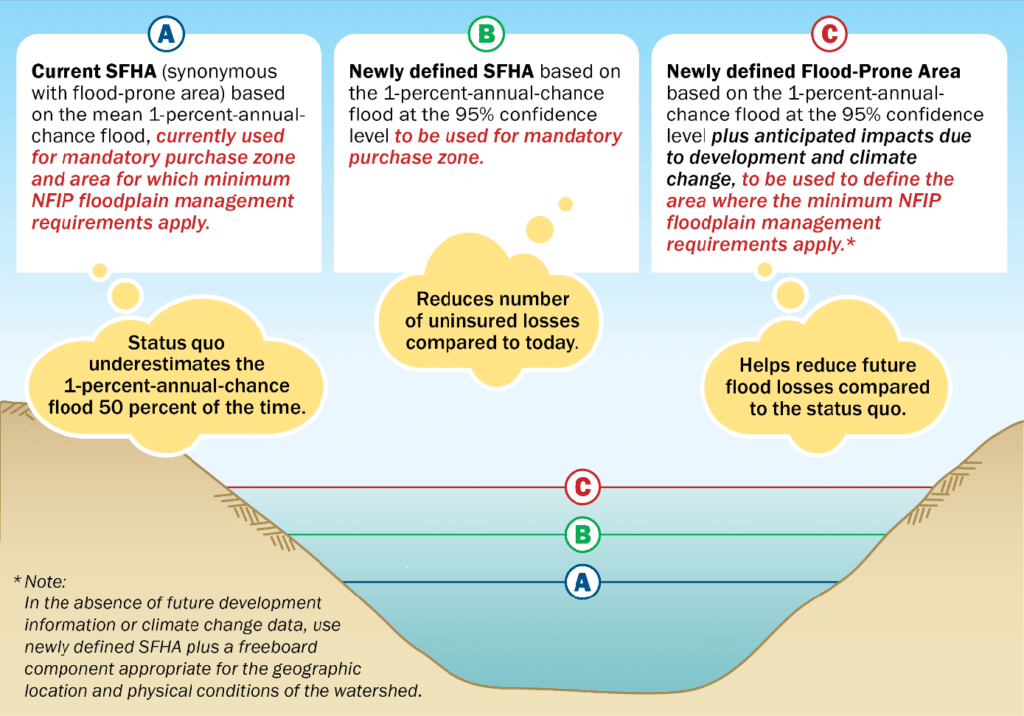
- FEMA should develop two flood hazard areas: 1. Special Flood Hazard Area (SFHA) – to be used for determining mandatory purchase requirements based on existing conditions; and 2. Flood-Prone Area (FPA) – to be used for floodplain management requirements based on future conditions.
- FEMA should develop Special Flood Hazard Areas based on the existing 1-percent-annual-chance flood by including estimates of uncertainty at the 95% confidence limit, not the mean, as is currently done.
- FEMA should require the flood hazard area developed for FloodProne Areas (FPAs), for the application of floodplain management requirements, be based on future conditions (including land use and climate change) at the 95% confidence limit.
- FEMA should develop the 0.2% chance flood based on the same parameters as the 1% including existing and future conditions.
- FEMA should include all requirements related to the placement of fill in flood-prone areas as part of the floodplain management requirements in 44 CFR 60.3.
- FEMA should require participating communities as part of permitting duties, to quantify and put on file the impacts of proposed fill and other development on flood stages and the environment prior to issuance of the fill permit. When increases in flood elevation or potential negative environmental consequences are found and cannot be mitigated, at a minimum property owners and appropriate environmental agencies must be notified prior to permit issuance.
“The tasking order and the recommendations address some significant issues that floodplain managers have been aware of for a number of years,” said Chad Berginnis, ASFPM Executive Director. “The recommendations are consistent with several of ASFPM’s policy positions regarding flood hazard identification and fill and it is great to see TMAC take action on them.”
The Technical Mapping Advisory Council (TMAC) is a federal advisory committee established to review and make recommendations to FEMA on matters related to the national flood mapping program. ASFPM members on the committee include Brooke Seymour and Maria Cox-Lamm, who also serve as co-Chairs of ASFPM’s Mapping and Engineering Standards Committee, and Jeff Sparrow, who is the representative for floodplain management organizations.
The final report is expected in Spring 2024. Download the interim report