Managing Residual Flood Risk Behind Levees: An International Comparison
Although hydraulic infrastructure such as levees remain important for flood risk management in the United States, France, and Canada, there is increasing emphasis on nonstructural measures, such as regulatory flood maps, to reduce exposure and vulnerability, for example, preventing people from building in high hazard areas. One key concept related to areas protected by levees is that of “residual risk”, that is, the risk from floods greater than the design standard of the levees (levee overtopping) and from levee breach.
Co-authored by Anna Serra-Llobet, co-chair of ASFPM’s International Committee, this article reviews the legislative framework for regulatory flood maps in the U.S., France, and Quebec, Canada and compares how residual risk behind protective structures is taken into account (or not) in regulatory flood maps.
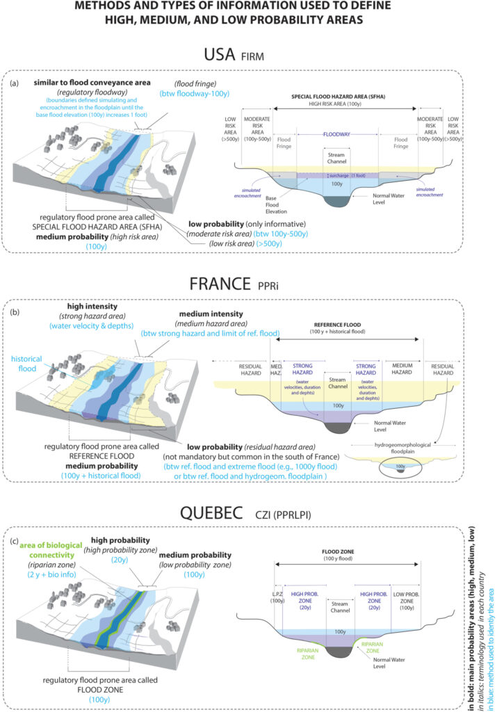
It finds big differences in how the U.S., France and Canada manage residual risk behind the levees. While in France the area behind levees is part of the regulatory flood prone area, and land use restrictions, building codes, emergency measures and risk communication are mandatory, in the U.S. the area behind levees is only shown as part of the regulatory flood prone area if the levee is not accredited. In Quebec, regulatory flood maps in general follow the French approach with a few exceptions.
Read the full open-access article on the Journal of Flood Risk Management site.