How the ‘Safe Development Paradox’ Shapes Risky Floodplain Growth
Traditional methods of communicating flood risk may unintentionally foster a false sense of security, driving increased development in flood-prone areas. This unintended consequence is known as the “safe development paradox,” as outlined in a new study from North Carolina State University. Lead author Georgina Sanchez, a research scholar at NC State’s Center for Geospatial Analytics, highlights how FEMA’s flood zone classifications might inadvertently contribute to this issue.
FEMA’s flood mapping system identifies areas based on their annual probability of flooding, defining zones like the 100-year floodplain, which has a 1% annual chance of flooding. These classifications serve as the foundation for regulations, such as determining who must purchase flood insurance. Areas within the 100-year floodplain are labeled “high risk,” but Sanchez explains that this designation may create the misleading impression that areas outside this boundary are entirely safe.
“What our current methods do is draw a line between the 100-year floodplain, which is considered ‘high risk,’ and everything outside of it. We communicate flood risk in a way that says you are either on the ‘at risk’ side of that line, or the ‘minimal risk’ side,” Sanchez said. “If you are on the ‘safe’ side, then you are not required to purchase flood insurance or meet strict structural requirements. It then becomes more affordable to live just outside the floodplain, where the perceived risk is lower, yet you are still close to the beautiful lakes, rivers and coastlines we love.”
This, Sanchez said, creates a mechanism that clusters development just beyond the highest-risk flood areas, even though in reality the risk extends beyond the floodplain’s edge.
Previous research on the safe development paradox has focused on the “levee effect,” in which the creation of flood-prevention structures gives the false impression that an area is safe from flooding and thus attracts increased development. This in turn leads to concentrated losses if a flood event exceeds what the flood-prevention structure was designed to withstand.
In focusing on regulatory floodplain mapping instead of these structures, Sanchez and her collaborators uncovered another example of the paradox, where efforts to reduce flood risk paradoxically intensify it by promoting development immediately outside of designated “high-risk” zones.
By overlaying floodplain maps from over 2,300 counties with data on prior development trends and simulated future development, researchers found evidence for the safe development paradox from the national level down to the county level. The study found that as much as 24% of all development nationwide occurs within 250 meters of a 100-year floodplain, and projections indicate that this number will continue to grow through at least the year 2060 without new policies to prevent flood exposure.

Image (a) shows the distance zone in each county with the highest percentage of developed land (i.e., as a proportion of total land area in each zone) in 2019, and (b) the number of counties with the highest percentage of developed land in each zone. Areas in white are not fully mapped by FEMA and excluded from the study. State and county boundaries are public domain data sourced from the U.S. Census Bureau’s TIGER/Line Shapefiles. All other data produced by the authors. https://doi.org/10.1371/journal.pone.0311718.g008
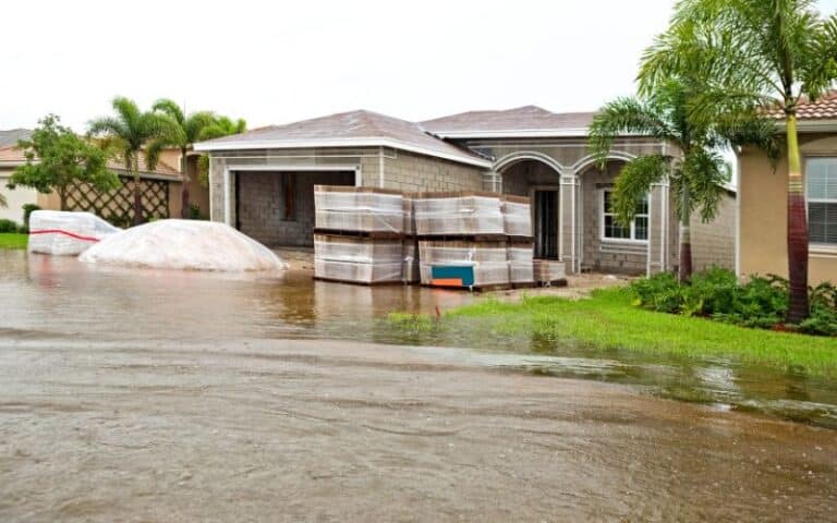
While the study concluded in 2019, these findings are apparent in the recent destruction caused by Hurricane Helene in western North Carolina, Sanchez said.
“Because of the steep topography in places like western North Carolina, there is an even greater concentration of development compared to flatter areas,” she said. “Developers tend to seek land that is flat enough to build on, which often happens to be along stream networks and closer to flood-prone areas.
“When I saw the news after Helene and looked at the images from the region, I could painfully see the findings of our study reflected in those scenes.”
The paper, “The Safe Development Paradox of the United States Regulatory Floodplain,” is published in PLOS ONE. Co-authors include Margaret A. Lawrimore, Anna Petrasova, John B. Vogler, Elyssa L. Collins, Vaclav Petras, Truffaut Harper, Emma J. Butzler and Ross K. Meentemeyer.