February 3, 2025
ASFPM Announces Update of Great Lakes Coastal Resilience Planning Guide
By News Editor
The Great Lakes Coastal Resilience Planning Guide will help community officials address coastal hazards, such as flooding, erosion, and lake-level fluctuations.
February 5, 2024
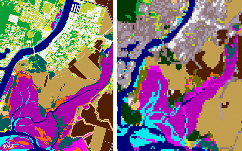
NOAA Releases New Land Cover Data to Boost Coastal Resilience
By News Editor
High-resolution land cover data can support many critical applications, such as assessing flood risk, developing predictive models, and understanding land use impacts.
November 17, 2023
Upcoming Webinar: Partnerships in Planning for Coastal Resilience
By News Editor
This is part of FEMA’s Policy to Action webinar series.
September 18, 2023
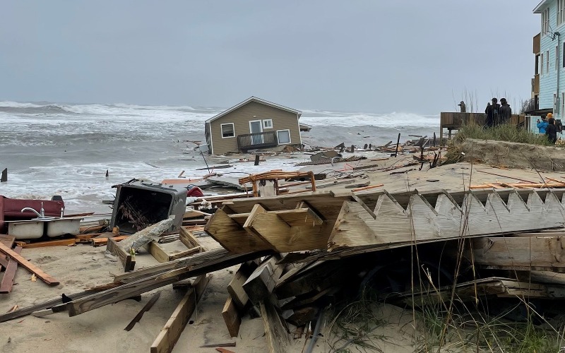
No Easy Solutions for Coastal Communities
By Catherine Kozak
The effects of severe beach erosion have been on full display in Rodanthe, NC.
March 14, 2023
Winners for Great Lakes Regional Challenge Announced
By News Editor
In Summer 2023, four communities will participate in a coastal resilience training and peer exchange workshop.
October 15, 2022
New Data from NOAA Provides Insight into How Flooding Affects Employment
By News Editor
ASFPM and NOAA are interested in hearing from readers who have used employment data to inform their flood risk mitigation and communication strategies.

October 11, 2022
Technical Assistance Program to Help Great Lakes Coastal Communities
By News Editor
Strengthening Coastal Counties Resilience Challenge to help Great Lakes communities develop policies and plans to improve their community’s resilience to coastal flooding.
April 1, 2021
Reducing Development in High-Risk Coastal Areas
By Larry Larson, P.E., CFM
Development in high-risk coastal areas is increasing faster than in lower risk areas. Is there something we’re doing as a nation to encourage this behavior despite the known dangers?