September 5, 2025
NOAA’s Flood Inundation Mapping Tool Expands to 60% of U.S.
By News Editor
FIM helps provide approximate spatial estimates of land area that is covered in water, based on modeled forecast river flows and current conditions, with detailed information on where flooding impacts may occur.
November 9, 2022
Climate Risk and Resilience Portal Aims to Help Boost Preparedness
By News Editor
ClimRR can help officials understand community vulnerabilities in the face of future climate risks.
September 9, 2022
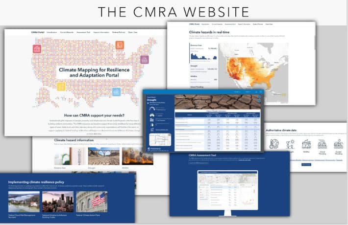
New Portal to Help Communities Assess Exposure to Climate Hazards
By News Editor
The Climate Mapping for Resilience and Adaptation (CMRA) portal features maps, data, and resources to support climate resilience planning across five key climate hazards: extreme heat, drought, wildfire, flooding, and coastal inundation.