Why Finishing the Nation’s Flood Maps Is More Critical Than Ever
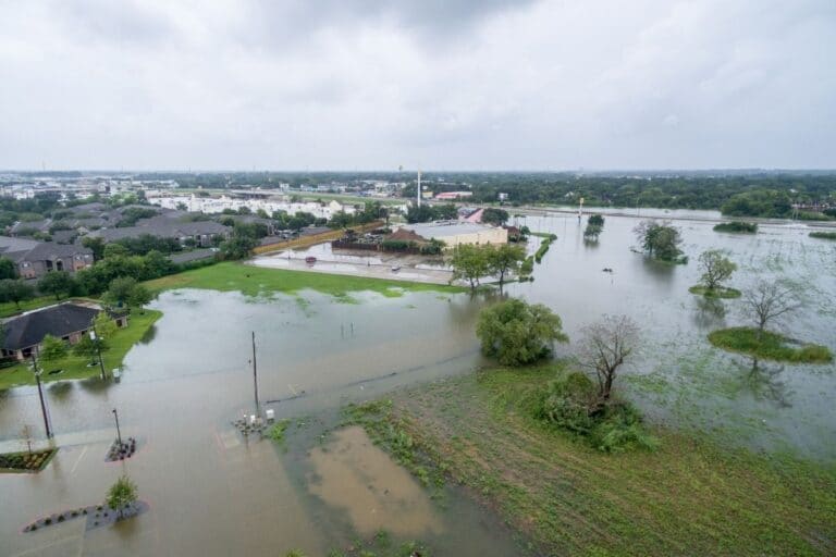
A few days ago, a report landed in my inbox with a noteworthy finding: 78% of properties affected by Hurricane Debby were located outside FEMA’s Special Flood Hazard Area (SFHA) or 100-year floodplain. It went on further to say that nearly $10 billion of the storm’s estimated $12 billion in damage occurred outside the SFHA. Debby, a slow-moving Category 1 hurricane at landfall, followed a familiar recent trend of storms that linger while dumping tremendous amounts of rain in their path.
I read this report a couple of days before leaving for a trip to Washington, DC where ASFPM’s policy team spent two days meeting with various House of Representative members and educating their offices on the nation’s critical floodplain management needs. In many of the meetings, we discussed flood mapping. Why? Because it is one area where chronic underinvestment has led to a staggering increase in flood losses. When we’ve only mapped about one-third of the nation’s floodplains, we can’t possibly hope to practice good land use, have effective codes and standards, know where we should prioritize buying flood insurance, and think that nationwide we are going to show real progress in slowing or stopping the increase in flood losses. So what is the solution? I will summarize it in one sentence: Finish the job mapping the country using FEMA’s Future of Flood Risk Data framework incorporating the Technical Mapping Advisory Council’s 2023 Report’s recommendations on flood mapping while also completing the rulemaking effort to update the NFIP minimum building and land use standards. See that was easy, right? OK, so let’s unpack this a bit.
First, we need to convince Congress that we have a flood mapping problem in the country. While the
Biden Administration had requested $363 million on flood map funding earlier this year, the House’s
proposed flood mapping budget for FY25 is only $312.75 million, which is a 14% reduction from the President’s request.
And, at current funding levels, we are making almost no progress in mapping the streams, rivers, and other areas that have not yet been mapped. ASFPM’s latest version of its Flood Mapping for the Nation report estimates it will cost between $3.2 and $11.8 billion to complete the job mapping the nation’s flood hazards. As we said several times to Congressional staffers over the past couple of days, for less than the cost of flood damages of one Category 1 Hurricane Debby, we could fund the entire effort to update the nation’s flood maps.
Second, FEMA needs to transition its Future of Flood Risk Data (FFRD) initiative from a conceptual design and testing phase and into nationwide implementation. The FFRD initiative has been around for several years and we are now at the point where some pilots are being conducted and mock ups of various data products are being produced. From what I have seen, FEMA is on the right track and the new products do a good job of much more comprehensively communicating flood risk that actually exists (spoiler alert — flood hazards are typically a whole lot more extensive than what we see on existing FIRMs). I also believe that this will elevate the FEMA flood mapping and risk data products to meet public expectations that what FEMA produces reasonably reflects the actual flood risk in a given area.
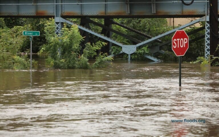
Third, the FFRD approach needs to incorporate two very important TMAC recommendations from its 2023 report: 1) map and separate Special Flood Hazard Areas from more comprehensive and forward looking Floodprone Areas (FPAs), and 2) to have these areas based on the 95% confidence limit. I urge everyone to read this report and the rationale behind these two recommendations. To explain our current situation in the context of the statistics cited at the beginning of this column, something isn’t quite right with our maps when we have significantly higher flood losses outside of the mapped floodplain. Remember, today’s flood maps are based on a 50% confidence limit which means it is a 50/50 chance that the map reflects the actual 100-year flood (and the 50% confidence limit was a compromise made in the early days of the NFIP). No wonder we keep seeing headlines after many flood events about these large losses outside of known floodplains.
Finally, FEMA needs to complete a comprehensive update of the NFIP’s minimum land use and building standards which — if we follow the TMAC recommendations — would apply in Special Flood Hazard Areas and Flood Prone Areas. We would end the dynamic that is really plaguing communities all over the country with housing subdivisions being built in areas that were never mapped because they were farm fields with low/no risk and, as a result, built with minimum resilience to today’s and tomorrow’s floods.
FEMA’s minimum floodplain standards haven’t substantially changed in more than 40 years and we have learned much in that time. On January 5, 2021, ASFPM and the Natural Resources Defense Council, petitioned FEMA to initiate rulemaking to update these standards. FEMA’s response to the petition was favorable. In the years since, FEMA has issued a Request for Information (RFI) and according to the Administration’s current regulatory agenda, the long term goal (defined as no regulatory action will occur in the next 12 months) is FEMA “will propose regulations to better align the NFIP minimum floodplain management standards with FEMA’s current understanding of flood risk, flood insurance premium rates, and risk reduction approaches to make communities safer, stronger, and more resilient to increased flooding.”
Unfortunately, we are only about two-thirds the way through 2024 and already we have seen massive flood losses. As a nation we are on pace to once again double our average annual flood losses this decade to over $40 billion annually. We have to do something to stop the hemorrhaging and finally finishing the job of getting accurate flood maps for the entire nation is a good place to start.
Your partner in loss reduction,