2020 Conference, Plenaries & Concurrent Presentations

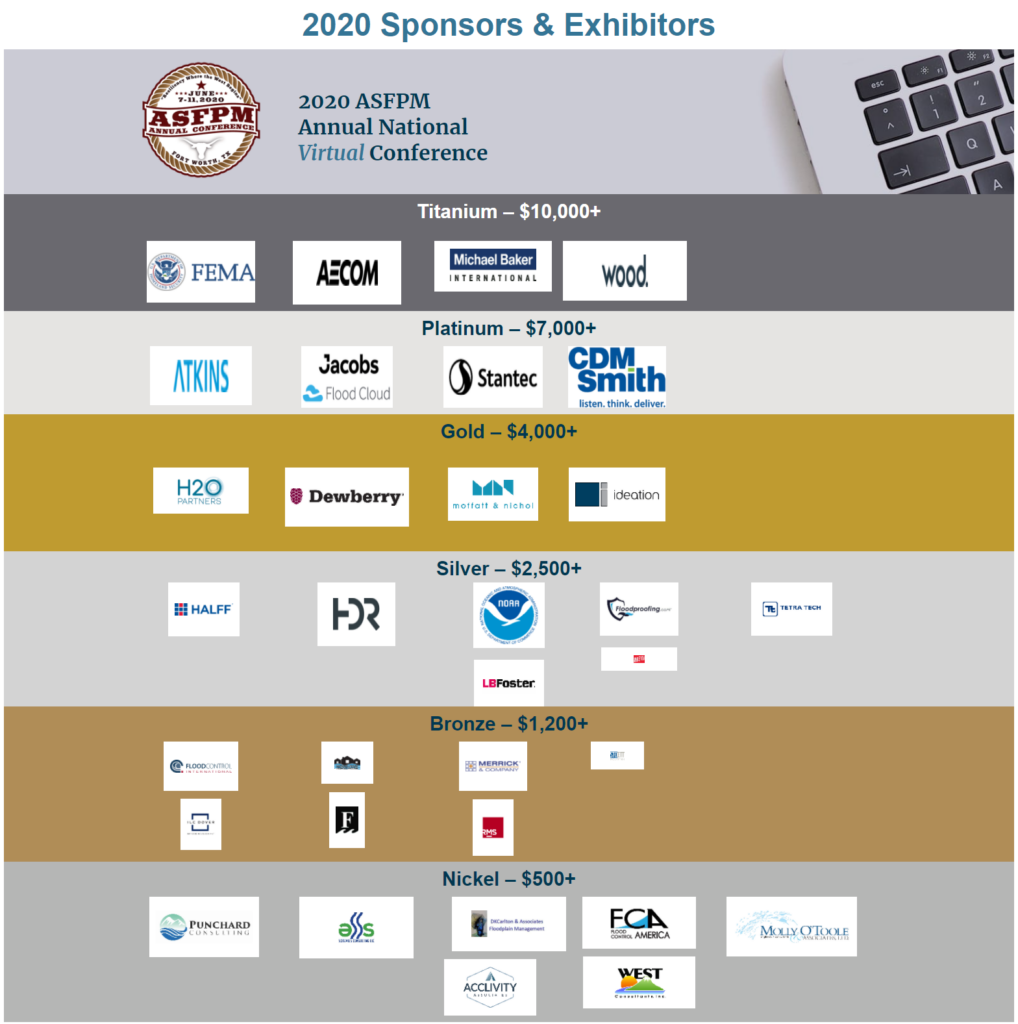
2020 ASFPM
Annual National
Virtual Conference
Session Presentations
Note: Viewing the videos listed on this page is not eligible for CECs. To earn CEC for viewing the 2020 conference program, please visit ASFPM’s virtual conference site.
Plenary Session 1
Flood Challenges and Solutions: Everything is Bigger in Texas
Use the links below to jump to a section of this plenary or view the whole plenary session in the video above.
Welcome Address: Chad Berginnis, CFM, ASFPM Executive Director
Kathleen Jackson, Board Member, Texas Water Development Board
Kevin Shunk, PE, CFM, Floodplain Administrator, City of Austin
Moderator: Chad Berginnis, CFM, ASFPM Executive Director
Plenary Session 2
Managing Flood Risk in a Changing World
Use the links below to jump to a section of this plenary or view the whole plenary session in the video above.
Sam Medlock, Senior Counsel, Select Committee on the Climate Crisis, U.S. House of Representatives
Sarah Murdock, Director, U.S. Climate Resilience and Water Policy, The Nature Conservancy
Moderator: Shannon Riess, CFM, ASFPM Vice Chair
Plenary Session 3
Federal Partnerships Enable Local Success
Use the links below to jump to a section of this plenary or view the whole plenary session in the video above.
Stacey Brown, PMP, SES, Chief, Planning and Policy Division, U.S. Army Corps of Engineers
David Stearrett, CFM, Director, Office of the Flood Insurance Advocate, FEMA
Moderator: Carey Johnson, Assistant Director, Kentucky Division of Water, ASFPM Chair-Elect
2020 ASFPM Awards Ceremony
Virtual Presentation of ASFPM Awards
ASFPM is pleased to present the winners of its 2020 awards. These annual awards recognize the outstanding contributions by individuals, agencies, and organizations who are advancing the association’s mission to reduce the loss of human life and property damage due to flooding.
Important: Viewing the videos listed on this page is not eligible for CECs. To earn CEC for viewing the 2020 conference program, please visit ASFPM’s virtual conference site.
Note: Each concurrent session below is one YouTube video and comprises each of the presentations listed. The link on the session name (e.g., A4: Floodplain Management Policy) goes to the start of the session. The link on each individual presentation goes to that presenter’s starting point. Bookmarks to each presenter can also be found in the description section of YouTube (click “Show More”).
Concurrent Sessions
Concurrent Session A – Tuesday, June 9
Track: Mapping A1: State Mapping Initiatives
A1 – Developing Base Level Engineering for Texas Watersheds – A Cooperating Technical Partners Initiative by Jacquelyn Hayes, CFM, Texas Water Development Board
A1 – Paper to the Future: Colorado from Paper Maps to Risk MAP and Beyond by Thuy Patton, CFM, Colorado Water Conservation Board
A1 – The Kansas 2D BLE Statewide Initiative by Tara Lanzrath, CFM, Kansas Department of Agriculture
Track: Modeling A2: Modeling for Design
A2 – SRH-2D vs. HEC-RAS: A Case Study on Bridge Modeling Hydraulics by Matthew Hornack, PE, CFM, ESP Associates
A2 – 2-D in the Water Resources Mainstream: Eye Opening Case Studies of Simplicity & Value by Rachel Pichelmann, PE, CFM, SEH
A2 – An Inundated Highway Parallel to the Floodplain: Modeling to Protect Bridge Infrastructure by Kyle Miller, PE, CFM, Meshek & Associates, LLC
Track: Mitigation A3: Resilience: Definition, Policy, and Practice
A3 – What is Resilience and why is it important that we define it? by Rob Flaner, CFM, Tetra Tech, Inc.
A3 – How Cities and States are Using Policy to Prepare for the Next Flood by Matthew Fuchs, JD, The Pew Charitable Trusts
A3 – An Integrated Approach to Coastal City Flood Resilience by Adam Hosking, C.WEM, C.Sci., Jacobs
Track: NFIP A4: Floodplain Management Policy
A4 – ESA and the NFIP: Protecting Endangered Species in Pacific Northwest Floodplains by Erin Cooper, CFM, FEMA
A4 – Floodways – Original Intent by Alan Lulloff, PE, CFM, ASFPM
A4 – Shifting from Binary to Graduated View of Flood Risks: 100-Year Standard Past and Future by Phetmano Phannavong, PE, PMP, CFM, Atkins
Track: Risk Communication A5: Risk Communication Tools that Work (and some that don’t)
A5 – If you build it, they (probably) won’t come. by Wes Shaw, Blue Urchin LLC
A5 – Piloting Resilience Innovation: How to build the plane while flying by Kristin Murphy, ICAgile Certified Professional, Level 4 Social Marketer (CIM), Booz Allen Hamilton
A5 – Billboards vs. Facebook – Keys to a Flood Education Program’s Success by Brian Edmondson, PE, CFM, Harris County Flood Control District
Track: Post-Disaster A6: Learning from Recent Major Flood Events
A6 – Ocracoke After Dorian: Substantial Damage Assessments on a Remote Barrier Island by Eryn Futral, AICP, CFM, CZO, NC Emergency Management
A6 – 2019 Nebraska Flood Overview & the Importance of Post-Event Data Collection by Jamie Reinke, PE, CFM, Nebraska Department of Natural Resources
A6 – May 2019 Arkansas River Flood: An Emergency Operations Center Perspective by Brandon Claborn, PE, CFM, Meshek & Associates, LLC
Concurrent Session B – Tuesday, June 9
Track: Mapping B1: Prioritizing & Ranking Mapping Needs
B1 – The Indiana DNR Floodway Reaches / CNMS Cost Estimating Tool by David Knipe, PE, CFM, Indiana Dept. Natural Resources
B1 – Every State and Territory Needs a Flood Risk Data Business Plan by Stephen Noe, Wood
B1 – NOAA’s Adapting Stormwater Management for Coastal Floods – a decision support tool for Coastal Communities facing Sea Level Rise by Stephen Bourne, PE, Atkins
Track: Modeling B2: Beyond the 100-Year: Probabilistic and Frequency Analysis
B2 – Using Cloud Computing Infrastructure for Intensive Flood Risk Modeling by Jeffrey Albee, Stantec
B2 – Are Unit Hydrograph Methods Still Relevant by Mitchell Blum, PE, CFM, HDR
B2 – Listening to Community Feedback When Performing Hydrologic Analysis: the Nisqually River Case by Ana Simões, PhD, PH, CFM, STARR II – Atkins
Track: MitigationB3: Mitigating Risk for Community Lifelines
B3 – Hardening Your Water Utilities – Protective Measures to Reduce Future Damage by Roger Lindsey, PE, CFM, Metro Nashville Water Services
B3 – Port Authority of NY & NJ JFK International Airport Stormwater Outfalls and Port Newark Building 111 by Joseph Albani, PE, Tetra Tech
B3 – Addressing High Risks With Limited Funding: Fort Worth’s Hazardous Roadway Overtopping Program by Kiran Konduru, PE, CFM, City of Fort Worth
Track: NFIP B4: Local Floodplain Manager Processes and Duties
B4 – Working Together to Simplify Permitting in the Trinity River Corridor by Lisa Biggs, PE, CFM, City of Fort Worth
B4 – The Big One Hit! Now What? by Lori Laster, PE, CFM, Papio Missouri River Natural Resources District
B4 – Risk Rating 2.0 and What it Might Mean to the Local Floodplain Administrator by Angela Michaels, PE, CFM, Engineering with a Mission, LLC
Track: Risk Communication B5: Risk-Informed Decision Making
B5 – Exploring factors that influence home buyers’ flood risk perception by Tracy Friend, PMP, AECOM
B5 – Communicating uncertainty and risk in flood forecasts: how does probabilistic information affect decision-making? by Kate Semmens, PhD, Nurture Nature Center
B5 – Probabilistic Flood Risk Analysis to Support Risk Informed Decision-Making by Seth Lawler, Dewberry
Track: Natural and Beneficial FunctionsB6: Benefits of Stream Restoration
B6 – Economic Impact of Floodplain Restoration on Property Values and Revenue by Brandon Parsons, PLA, American Rivers
B6 – Returning Ecology to Cities – Renaturalization of Concrete Lined Urban River Systems by Jonathon Kusa, PE, Inter-Fluve, Inc.
B6 – Urban Wetlands Protection and Restoration for Hazard Management by William Dooley, Association of State Wetland Managers
Concurrent Session C – Tuesday, June 9
Track: Mapping C1: Transforming the Floodplain Mapping Program
C1 – The Living Flood Study: Multi-Application Flood Risk Analyses by Mathew Mampara, PE, Dewberry
C1 – It is Time to Change how FEMA Maps Coastal Flooding – A Proposal by Cheryl Johnson, PE, CFM, PMP, AECOM
C1 – In Pursuit of Accuracy by Josha Crowley, PE, PMP, CFM, D.WRE, STARR II – Atkins
Track: Modeling C2: Modeling Complex and Unique Systems
C2 – Evaluating Downstream Impacts of Flood Control Projects by Streambed Mobilization Energy by Dragoslav Stefanovic, PhD, PE, D.WRE, HDR
C2 – Lacustrine Hydrologic Modeling of Lake Champlain by Rebecca Starosta, PE, CFM, AECOM
C2 – Innovative Combined Coastal/Inland Flooding Models and Solutions for Use in Coastal/Estuarine Areas to Enhance Resilience by Johnny Martin, PE, Moffatt & Nichol
Track: Mitigation C3: Building Science and Floodproofing
C3 – Giving multi-family buildings a new lease on life from Flooding by Manuel Perotin, PE, PMP, CFM, CDM Smith
C3 – Building Codes Save: FEMA’s Nationwide Building Code Losses Avoided Study by Jonathan Westcott, PE, FEMA Building Science Branch
C3 – New Guidelines on Flood Adaptation for Historic Buildings from the National Park Service by Jennifer Wellock, National Park Service
Track: NFIP C4: Local Floodplain Regulations and Higher Standards
C4 – Adapting to Atlas 14: Austin’s Proactive Approach to a Higher Flood Risk by Garrett Johnston, PE, CFM, Freese and Nichols
C4 – Code Overhaul: A Comprehensive Look at How Disasters Can Give Rise to Changes in Land Use, Building, and Other Code Documents, and How to Get Out in Front of It by Chris Tagert, PE, CFM, Michael Baker International
C4 – Achieving Flood Resiliency Through Higher Standards Saves Communities’ Resources by Alan Johnson, PE, FEMA
Track: Risk Communication C5: Unique Approaches to Risk Communication
C5 – The Mitigation Message Calendar: A Tool for Social Media by Cindy Wirz, Federal Emergency Management Agency, Region 6
C5 – Experiential Learning and Pop-Ups for Resilience by Peter Herrick, Jr., FEMA
C5 – Engaging the Arts to Promote Disaster Risk Reduction by Jack Heide, AICP, CFM, FEMA Region II
Track: Watershed C6: Watershed-Scale Flood Management Initiatives
C6 – International guidelines for use of Natural and Nature-Based Features: supporting a new age of flood management by Jonathan Simm, PhD, C.Eng., HR Wallingford
C6 – Snapshot of the Louisiana Watershed Initiative by Patrick Forbes, Louisiana Office of Community Development
C6 – Watershed-based Approaches in SE Wisconsin by Karen Sands, AICP, Milwaukee Metropolitan Sewerage District
Concurrent Session D – Wednesday, June 10
Track: Mapping D1: To BLE or Not to BLE
D1 – Base Level Engineering to Detailed Studies by Jack Young, PE, CFM, PMP, Halff Associates, Inc.
D1 – Efficient Regional Scale Flood Mapping – Indicative Fluvial Flood Map for Ireland by Emma Brown, M.Eng., C.Eng, HR Wallingford
D1 – Building Community Capability with the Base Level Engineering Desk Reference by Elizabeth Savage, PE, HWC, Inc.
Track: Modeling D2: Future of Flood Modeling
D2 – Hydrologic and Hydraulic Modelling: Today’s (and Tomorrow’s) Design Scenarios by Scott Blossom, PE, CFM, LEED AP, Blossom Consulting and Engineering, Inc.
D2 – Climate Change in Your Home Town: An overview of how what we see in the media can be distilled into a practical application of future flood risk for your community by Andrew Park-Friend, PE, Michael Baker International
D2 – System Wide Flood Risk Analysis using Integrated Coastal and Inland Modeling and Tools Development to Analyze Large Asset Database: JEA System Wide Resiliency Program by Swamy Pati, PhD, PE, CFM, Jacobs
Track: Mitigation D3: FEMA Mitigation Programs and Grant Applications
D3 – The New Building Resilient Infrastructure and Communities (BRIC) Program: What Stakeholders Should Know by Camille Crain, FEMA
D3 – Best Practices for Large Infrastructure Projects in the PDM and FMA Programs by Eric Kenney, PE, PMP, CFM, CDM Smith
D3 – A History of Hazard Mitigation and Historic Preservation in North Carolina by Mike Robinson, CFM, Moffatt & Nichol
Track: NFIP D4: Dam and Levee Planning and Risk Communication
D4 – Emergency Action Planning for Dams and Other Tools to Communicate Dam Risk by Meg Galloway, PE , ASFPM
D4 – Minot’s Road to Recovery: A Section 408 Success Story by Joe Waln, PE, CFM, Barr Engineering Co.
D4 – Community Education, Outreach, and Success Stories for Levees by Brian Koper, CFM, Risk Management Directorate | Federal Insurance & Mitigation Administration
Track: Risk Communication D5: Equity Considerations in Floodplain Management
D5 – Equitable Engagement for Flood Risk and Resilience Work by Miriam Belblidia, CFM, MPA, Arcadis
D5 – Flood History Disclosure: A Case Study from Charleston, SC by Ana Zimmerman, PhD, College of Charleston
D5 – Participatory Design for Greater Stakeholder Inclusion & Better Outcomes by Marcus Coleman, HWC
Track: Showcase D6: AECOM Experts Sharing Best Practices for Today and Into the Future
D6 – Building Local Community Resilience to Climate Change by Justin Vandever, PE, AECOM
D6 – Flood hazard and risk data in the future – what opportunities are starting to unfold? by Andy Bonner, PE, PMP, CFM; Marcia Tobin, AICP; John Dorman; Hope Morgan, NCPLS, GISP, CFM; Cheryl Johnson, PE; Jennifer Moss, CFM; AECOM
D6 – Virtual Engagement: The New Normal in the Era of Social Distancing by Laura Adleman, CFM; Christine Estes, PE, CFM; AECOM
Concurrent Session E – Wednesday, June 10
Track: Mapping E1: Risk Products Tailored to Community Needs
E1 – Technical Collaboration, Federal and Local – Success stories in Region 10 by Soumya Sagarika, PE, CFM, Atkins
E1 – Hot ‘n Cold Flooding – Post-Fire, Ice Jamming, and Snowmelt in the Animas River Watershed by Isaac Allen, PE, CFM, AECOM
E1 – Beyond a Line on a Map: How to Enhance Coastal Resiliency Along Eroding Shorelines in New England by Brian Caufield, PE, CFM, D.CE, CDM Smith
Track: Modeling E2: Modeling Texas Style
E2 – Empower Resilience for Harris County while Implementing NOAA Atlas 14 Precipitation by Ataul Hannan, PE, CFM, Harris County Flood Control District
E2 – 1D Models Cannot Handle Texas Sized Floodplains by Russell Jones, PE, HDR
E2 – Real World Application of HEC-RAS 2D Modeling: Rehabilitation of the Richland-Chambers Wetlands by Craig Ottman, PE, CFM, Tarrant Regional Water District
Track: Mitigation E3: Coastal Resilience: Policy and Projects
E3 – U.S. Federal Climate Resiliency Policy: Is the Political Divide being Bridged? by Sarah Murdock, The Nature Conservancy
E3 – Living Shorelines: Where they Make Sense in a Floodplain Management Context by Emily Dhingra, CFM, PE, PMP, AECOM
E3 – Integrated Strategies for Resilience to Future Flooding in Virginia Beach, VA by Brian Batten, PhD, CFM, Dewberry
Track: NFIP E4: CRS – National Perspective
E4 – A CRS Program Update: 2021 Addendum to the CRS Coordinator’s Manual by Molly O’Toole, PE, DWRE, CFM, Molly O’Toole and Associates, Ltd.
E4 – FEMA-USFWS-NMFS Partner to Incorporate Credit for Protecting Threatened and Endangered Species into the Community Rating System by French Wetmore, CFM, French & Associates, Ltd.
E4 – Maximizing CRS points for your Hazard Mitigation Plan by Maggie Talley, CFM, Jefferson Parish
Track: Risk Communication E5: Unique Approaches to Risk Communication 2
E5 – Water You Gonna Do? An Educational Game about Watershed Management by Justin Kozak, CFM, Center for Planning Excellence
E5 – Utilizing location technology for flood preparedness, management, mitigation, recovery and resilience by Dan Henderson, GISP, PMP, Esri
E5 – Using Augmented Reality to Communicate Flood Risk & Risk Management Solutions by John Covey, PE, CFM, Wood
Track: Showcase E6: FEMA Showcase: Perseverance, Progress & the Power of Partnerships
E6 – Perseverance, Progress, and the Power of Partnerships: FEMA’s Focus on Collective Action in the Age of COVID-19 by FEMA
Concurrent Session F – Wednesday, June 10
Track: Mapping F1: CTP Showcase
F1 – Making Risk Information More Available & Usable: Integrated Base Level Engineering by Whitney Montague, Arkansas Natural Resources Commission
F1 – Incorporating the 2020 Survey & RMD Priorities to Inform the CTP Program by Laura Algeo, PE, FEMA HQ
F1 – GA CTP’s Strategy to Shift a Community’s Role from a Bystander to an Active Participant by Shannon Brewer, PMP, CFM, Dewberry
Track: Modeling F2: Regulatory Implications on Modeling
F2 – Carson Creek Flood Risk Reduction Project: Consequences of “Redirecting” a Creek by Sunit Deo, PE, CFM, HDR
F2 – FEMA 2D modeling with Floodways: Case studies by Ferrin Affleck, PE, PMP, CFM, Atkins
F2 – FEMA Approach on 2D Floodways; Improving Tools and Updating Guidance by Rick Sacbibit, PE, FEMA
Track: Mitigation F3: Vulnerability and Risk Assessments
F3 – Saving Our Historic Building Stock through the Application of Nonstructural Mitigation by Randall Behm, PE, CFM, Behm Hazard Mitigation, LLC
F3 – A Pilot Study to Calculate Coastal Average Annualized Losses by Mike Onufrychuk, PMP, CFM, AECOM
F3 – Facilitating Resilience-Building Actions in Coastal Communities by Russell Jackson, NOAA’s Office for Coastal Management
Track: NFIP F4: State Floodplain Management Initiatives
F4 – Best Practices for Collaboration Between State and FEMA Regional Floodplain Management Programs by Celinda Adair, CFM, State of OR DLCD
F4 – Guidance for Flood Damage Prevention & Resilience in Rural Alabama by Corey Garyotis, PE, CFM, ADECA OWR
F4 – Data-driven Decisions: Connecting Risk Analysis to Floodplain Management by Jack Krolikowski, EIT, CFM, Georgia Department of Natural Resources
F4 – Floodplain Platform for Community Information by Traci Sears, CFM, MT DNRC
Track: Risk Communication F5: Language Matters in Risk Communication
F5 – The Flood Hazards Handbook: Supporting Community Flood Resilience in New Hampshire by Samara Ebinger, CFM, New Hampshire Office of Strategic Initiatives
F5 – The Problem With ‘Unprecedented’: Mitigating Misinformation & Improving Risk Communication by Jim Keith, PE, CFM, Freese and Nichols, Inc.
F5 – Leveraging the Power of Story for Policy Change, Local Mitigation Action in Multnomah County, Oregon by Kate Skaggs, CFM, Resilience Action Partners
Track: ASFPM Foundation F6: Student Paper Competition
F6 – Does Predator Presence Affect Stream Hydrology via Trophic Cascades? by Meg Zuercher, Saint Louis University
F6 – Modeling the Downstream Consequences of the 1976 Teton Dam Failure and Resulting Flood by Validating the GeoClaw Software with Historical Data by Hannah Spero, Boise State University
F6 – Dealing with the Deluge of Waste: Flood Waste Management in a Two-Tier City of India by Mahasweta Chakraborty, Tata Institute Of Social Sciences, Mumbai
Concurrent Session G – Thursday, June 11
Track: Mapping G1: Predictive & Real-time Inundation Mapping
G1 – Coastal Inundation Mapping and Impact Assessments for Hurricane Response in the Carolinas by Neal Banerjee, PE, CFM, ESP Associates, Inc.
G1 – Interactive and Real-time Flood Inundation Mapping on Client-Side Web Systems by Ibrahim Demir, University of Iowa
G1 – Hurricane Dorian Flood Inundation Forecast Mapping: Predicting Flooding to Save Lives by Maria Cox, CFM, South Carolina Department of Natural Resources
Track: Modeling G2: 2D Modeling Parameters
G2 – The 3D Nation Elevation Requirements and Benefits Study – Preliminary Results by Sue Hoegberg, CFM, GISP, Dewberry
G2 – Impacts of 2D Parameters – An XPSWMM Case Study by Brandon Hilbrich, PE, CFM, HDR
G2 – A Methodology for Efficiently Developing Large 2D HEC-RAS Models for Base Level Engineering by Kimberly Hetrick, CDM Smith
Track: Mitigation G3: Resiliency and Mitigation Planning
G3 – Infusing nature-based solutions into Hazard Mitigation Plans: Creating Resilient and Sustainable Communities for the 21st Century by Carey Johnson, Kentucky Division of Water
G3 – Mitigation Plan/ning Effectiveness: How engagement in the mitigation planning process results in risk reduction measures by Amanda Sharma, MRLS, CFM, FEMA HQ
G3 – Planning for Hazards: Implementing flooding-specific tools and strategies to reduce risk and build resilience by Ryan Carroll, CFM, Michael Baker International
Track: NFIP G4: NFIP Violations and Compliance
G4 – Turning the Ship: How Shady Cove survived probation, and how you can avoid it by Becca Fricke-Croft, CFM, Atkins
G4 – Second Steps in Correcting Violations by Steve Samuelson, CFM, Kansas Dept. of Agriculture, Division of Water Resources
G4 – DRRA 1206 and Floodplain Management – Where do we go from here? by Adrienne Sheldon, PE, CFM, FEMA HQ
Track: Risk Communication G5: Strategic Risk Communication: Understanding Behavior
G5 – Guidehouse Research and Approach to Driving Disaster Preparedness Through Behavioral Science by Adam Lucas, PMP, CSM, Guidehouse
G5 – “Bam What”? Statewide Risk Communications in Missouri by Alicia Williams, GISP, Wood Environment and Infrastructure, Inc.
G5 – Applying Data and Statistics to Amplify Your Message by Destiny Aman, HWC
Track: Stormwater G6: Stormwater Permitting, Planning and Projects
G6 – Using Planning and Nature-based Solutions to Achieve Co-Benefits for Water Quality and Hazard Mitigation by Dacia Mosso, Tetra Tech
G6 – Erosion Control Applications across the United States – Case Studies by Stefano Rignanese, Maccaferri, Inc.
G6 – Mitigating Urban Flooding in a Combined Sewer Area: A Philadelphia Case Study by Elise Ibendahl, PE, CFM, ENV SP, Jacobs
Concurrent Session H – Thursday, June 11
Track: Mapping H1: LOMC-PMR Process
H1 – MT-1s vs. MT-2s: Determining the Correct LOMC Process for your Project by Matt Richards, CFM, Michael Baker International
H1 – How LOMRs Affect LOMAs by Patrick Dobbs, PE, Wood
H1 – Processing PMRs: Challenges and Successes by Jeff Zanotti, CFM, Wood E&IS
Track: Modeling H2: Hydrologic Modeling Input
H2 – Mapping National Water Model (NWM) Forecasts with FEMA HEC-RAS Models – a Pilot Application in the Whitemarsh Run Watershed, Maryland by Jennifer McGee, PE, CFM, Wood PLC
H2 – Interagency Watershed Hydrology Assessments: Collaborating with Federal Partners to Address Hydrologic Challenges by Helena Mosser, PE, US Army Corps of Engineers
H2 – StreamStats: A web-based application for retrieving basin characteristics and streamflow statistics (such as the 1-percent flood) for gaged and ungaged streams. by Peter McCarthy, U.S. Geological Survey
Track: Mitigation H3: Measuring Resilience
H3 – Using Decision Support Tools to Build a More Resilient Georgia Coast by Ashby Worley, CFM, The Nature Conservancy
H3 – Empirical Disaster Resilience Study in North Carolina by Jae Park, CFM, PhD, AECOM
H3 – Show it in Writing – RELi as a Means for Documenting Resilience by David Sutley, PE, Dewberry
Track: NFIP H4: Local Floodplain Management Initiatives
H4 – Interdependencies in Floodplain Management: PHL Case Study by Josh Lippert, CFM, City of Philadelphia
H4 – Developing a Program to Manage Non-FEMA Flood Risks in Fort Worth, TX by Clair Davis, PE, CFM, City of Fort Worth
H4 – Hays County’s Progressive Approach to Resilience by Cindy Engelhardt, PE, CFM, Halff Associates, Inc.
Track: Risk Communication H5: Success Stories in Flood Risk Management and Communication
H5 – The Iowa Flood Center: A Model for the Nation by Witold Krajewski, PhD, Iowa Flood Center – University of Iowa
H5 – Flood Forecast Operations at the National Weather Service (NWS) West Gulf River Forecast Center (WGRFC) by Kris Lander, PE, CFM, NOAA National Weather Service
H5 – Empowering Local Officials to Talk Flood Risk: Stories from Year One of the Flood Risk Communication Toolkit and Videos Roll Out by Priscilla Scruggs, FEMA
Track: Stormwater H6: Local Stormwater Management Initiatives
H6 – Fort Worth’s Storm Drain Rehabilitation Program: Cowtown’s Approach To Wrangling Storm Drains by Matt Stahl, PE, AWAM, CFM, Halff Associates, Inc.
H6 – Planning of Transportation and Stormwater Infrastructure Together Before the Growth: An Opportunity for Flood Prevention in North Texas by Tamara Cook, AICP, North Central Texas Council of Governments
H6 – Risk Management in Site Design: Don’t Forget to Look Offsite by Byron Hinchey, PE, CFM, S&ME, Inc.
Concurrent Session J – Thursday, June 11
Track: Mapping J1: Local Flood Warning Systems
J1 – Building Real-Time Resiliency from the City of Fort Worth’s Flood Warning System by Ranjan Muttiah, PhD, PE, CFM, City of Fort Worth, Stormwater Management, TPW
J1 – Near Real Time Mapping Possible in 30 Minutes for 1,200 Miles in Harris County Because of Model and Map Management(M3) System by Ataul Hannan, PE, CFM, Harris County Flood Control District
J1 – Getting Ahead of the Storm: Densifying NC’s Stream Gage Network by Dean Goodison, PE, CFM, Atkins
Track: Modeling J2: Dam and Levee Breach Modeling and Risk Assessments
J2 – Estimating Residual Risk Behind Levees with Breach Modeling by Geoffrey Uhlemann, PE, CFM, AECOM
J2 – Sacramento County OES Flood Decision Support System (FODSS) Tool by Chris Ferrari, PE, CFM, GEI Consultants
J2 – Extreme Flood Mitigation by Dams under Present and Future Climate by Mark Bartlett Jr., PhD, PE, Stantec
Track: Mitigation J3: Acquisition and Elevation Projects – Guidance/Successes
J3 – To Elevate, or not to Elevate, that is the Question by Kathy Hopkins, CFM, CTCM, TWDB
J3 – City of Austin Onion Creek Project: Show me the Money and we will show you the results by Teri Morgan, SR/WA, HDR, Inc.
J3 – Slab Home Elevations for Flood-proofing: Safety, Education, Training and Outreach by Nur Yazdani, PhD, PE, ASCE, F. ACI, F SEI, University of Texas Arlington
Track: NFIP J4: CRS – Local Perspectives
J4 – The Magic CRS Activity Tracking Tool by Lisa Foster, CFM, Pinellas County
J4 – CRS Activity 420: Designs for a Successful Open Space Program by Chris Mason, CFM, Collier County Growth Management Department
J4 – CRS Recommendations from Coastal Stakeholders & Viability of Regional CRS Support Positions in Virginia by Mary-Carson Stiff, CFM, JD, Wetlands Watch
Track: Risk Communication J5: Visualizing Flood Risk
J5 – Harnessing the Power of Immersive 3D Visualizations to Drive Flood Communications by Glenn Locke, PMP, Booz Allen Hamilton
J5 – Improving flood risk awareness and resiliency by using 3D rendering video game technology by Danielle Dami, Stantec
J5 – 2016 Baton Rouge Deluge: Reconstruction and 3D-Visualization of Historical Flooding Events by Janghwoan Choi, PhD, PE, CFM, Stream Methods, Inc.
Track: Showcase J6: Sponsor Showcase
J6 – CDM Smith Showcase: Policy Update: Floodplain Management Requirements for Agricultural Structures and Accessory Structures by Devin Schultze, PE, CFM, CDM Smith
J6 – Guidehouse Showcase: Chief Resilience Officers – The Evolution and Future of Their Role and Strategies to Drive Resilience by Jeremias Alvarez, PMP, CSM, Guidehouse
J6 – IBM Showcase: Automated Map Production by Jack Paxton, Andrew Ditmore, Rob Hardin, IBM