Flood risk perception in lands “protected” by 100-year levees
Natural Hazards
DOI: 10.1007/s11069-011-0072-6
Flood risk perception in lands “protected” by 100-year levees
Jessica Ludy and G. Matt Kondolf
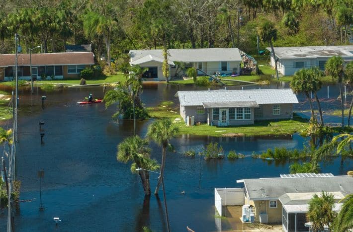
Under the US National Flood Insurance Program, lands behind levees certified as protecting against the 100-year flood are considered to be out of the officially recognized “floodplain.” However, such lands are still vulnerable to flooding that exceeds the design capacity of the levees—known as residual risk. In the Sacramento-San Joaquin Delta of California, we encounter the curious situation that lands below sea level are considered not “floodplain” and open to residential and commercial development because they are “protected” by levees. Residents are not informed that they are at risk from floods, because officially they are not in the floodplain. We surveyed residents of a recently constructed subdivision in Stockton, California, to assess their awareness of their risk of flooding. Median household income in the development was $80,000, 70% of respondents had a 4-year university degree or higher, and the development was ethnically mixed. Despite the levels of education and income, they did not understand the risk of being flooded. Given that literature shows informed individuals are more likely to take preventative measures than uninformed individuals, our results have important implications for flood policy. Climate-change-induced sea-level rise exacerbates the problems posed by increasing urbanization and aging infrastructure, increasing the threat of catastrophic flooding in the California Delta and in flood-prone areas worldwide.
To read further, please click here.